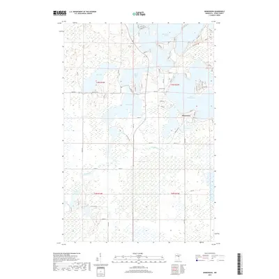
2019 Map of Minnewawa
USGS Topo · Published 2019About this map
Lake Minnewawa and the surrounding Aitkin County wetlands define this portion of northern Minnesota. This 2019 survey captures the settlement of Minnewawa and a landscape saturated with water, from the sprawling reach of Big Sandy Lake in the north to the meandering course of the Sandy River. The map detail reveals a community deeply integrated with its shoreline, where numerous small roads like Round Lake Rd and Tedna Dr provide access to the various peninsulas and lakefront properties. Genealogists and local historians will find the locations of Lakeview Cem and Shamrock Cem particularly valuable for tracing resident families. The intricate network of smaller water bodies, including Rat Lake, Flowage Lake, and Dollar Lake, illustrates the complex hydrology of the region, where the Minnewawa Cr drains through low-lying marshlands.
Find a feature on this map
67 named features on this map. Tap any name to fly to it.
Don’t see what you’re looking for? This feature index may not catch every label — zoom into the map to look around manually.
Map Details
Editions of this 2019 Minnewawa Map
This is the sole edition of this map. No revisions or reprints were ever made.
Other maps of this area

1953 · Duluth
USGS Topo · 1:250,000

1958 · Duluth
USGS Topo · 1:250,000

1969 · Lawler
USGS Topo · 1:24,000

1970 · Kimberly
USGS Topo · 1:24,000

1970 · Mc Gregor
USGS Topo · 1:24,000

1970 · Tamarack
USGS Topo · 1:24,000

1970 · Palisade
USGS Topo · 1:24,000

1970 · Sanders Lake
USGS Topo · 1:24,000

1970 · Balsam
USGS Topo · 1:24,000

1970 · Libby
USGS Topo · 1:24,000