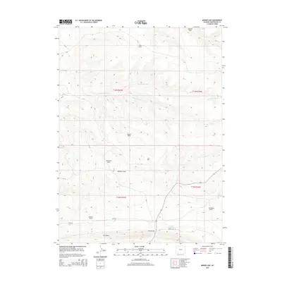
2015 Map of Minnies Gap
USGS Topo · Published 2015About this map
Minnies Gap provides a focal point for this section of Sweetwater County, where the high desert terrain of southern Wyoming is defined by a complex network of seasonal drainages and high plateaus. The landscape is marked by prominent natural features such as The Glades in the south and the high elevation of Iron Mtn. Water management and natural flow are evidenced by the presence of Jarvies Marsh Cr, Krause Marsh Cr, and Middle Marsh Cr, which wind through the township grids. These watercourses, along with Wildhorse Draw and Washam Wash, illustrate the importance of drainage basins like Wildhorse Basin and Buster Basin in this arid environment. Transportation across this corner of the state is limited to a few arterial routes, including Canyon Rd and Browns Park Rd, which connect the isolated basins and ridges.
Find a feature on this map
26 named features on this map. Tap any name to fly to it.
Don’t see what you’re looking for? This feature index may not catch every label — zoom into the map to look around manually.
Map Details
Editions of this 2015 Minnies Gap Map
This is the sole edition of this map. No revisions or reprints were ever made.
Other maps of this area

1885 · Ashley
USGS Topo · 1:250,000

1906 · Marsh Peak
USGS Topo · 1:125,000

1908 · Marsh Peak
USGS Topo · 1:125,000

1952 · Dutch John Mtn
USGS Topo · 1:24,000

1952 · Goslin Mtn
USGS Topo · 1:24,000

1952 · Flaming Gorge
USGS Topo · 1:24,000

1954 · Vernal
USGS Topo · 1:250,000

1954 · Rock Springs
USGS Topo · 1:250,000

1957 · Currant Creek Ranch
USGS Topo · 1:62,500

1958 · Vernal
USGS Topo · 1:250,000