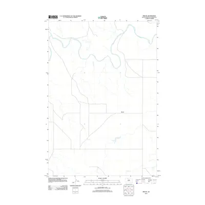
2012 Map of Miscol
USGS Topo · Published 2012About this map
Miscol anchors this quiet segment of the Rock Creek District within Corson County, situated south of the winding Grand River. The landscape is defined by the drainage patterns of several tributaries, most notably Joe Bush Cr and Plum Cr, which feed toward the river valley. As of the early 21st century, the map reflects a sparse settlement pattern characteristic of the Standing Rock Indian Reservation, with a rectilinear grid of local roads and sections providing the primary infrastructure for the area. The geography remains dominated by the broad meanders of the Grand River in the north, where the water table and seasonal flows dictate the use of the surrounding plains.
Find a feature on this map
4 named features on this map. Tap any name to fly to it.
Don’t see what you’re looking for? This feature index may not catch every label — zoom into the map to look around manually.
Map Details
Editions of this 2012 Miscol Map
This is the sole edition of this map. No revisions or reprints were ever made.
Other maps of this area

1953 · McIntosh
USGS Topo · 1:250,000

1956 · Miscol SW
USGS Topo · 1:24,000

1956 · Black Horse NE
USGS Topo · 1:24,000

1956 · Bullhead
USGS Topo · 1:24,000

1956 · Black Horse SE
USGS Topo · 1:24,000

1956 · Miscol SE
USGS Topo · 1:24,000

1956 · Miscol
USGS Topo · 1:24,000

1956 · Bullhead SW
USGS Topo · 1:24,000

1956 · Miscol NE
USGS Topo · 1:24,000

1958 · McIntosh
USGS Topo · 1:250,000