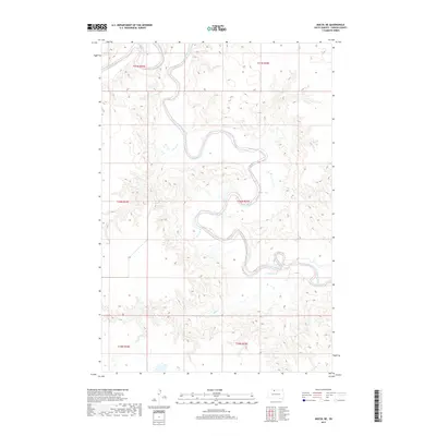
2017 Map of Miscol NE
USGS Topo · Published 2017About this map
The Grand River meanders through the heart of this landscape, carving a deep, serpentine valley across the plains of Corson County. This 2017 survey by the U.S. Geological Survey illustrates the dramatic physical geography of the region, where the river's winding path is joined from the south by the drainage of Plum Cr. The map highlights the sprawling drainage network of the Missouri River watershed, showing the intricate contouring of the river bluffs and the vast sections of land surveyed under the Public Land Survey System. Covering parts of townships T21N R24E and T20N R25E, the sheet provides a precise look at the natural hydrology of the Standing Rock Indian Reservation area, including numerous oxbows and seasonal wetlands that define the riparian corridor.
Find a feature on this map
8 named features on this map. Tap any name to fly to it.
Don’t see what you’re looking for? This feature index may not catch every label — zoom into the map to look around manually.
Map Details
Editions of this 2017 Miscol NE Map
This is the sole edition of this map. No revisions or reprints were ever made.
Other maps of this area

1953 · McIntosh
USGS Topo · 1:250,000

1956 · Miscol SW
USGS Topo · 1:24,000

1956 · Little Eagle SW
USGS Topo · 1:24,000

1956 · Bullhead
USGS Topo · 1:24,000

1956 · Miscol SE
USGS Topo · 1:24,000

1956 · Little Eagle NW
USGS Topo · 1:24,000

1956 · Miscol
USGS Topo · 1:24,000

1956 · Bullhead SW
USGS Topo · 1:24,000

1956 · Miscol NE
USGS Topo · 1:24,000

1958 · McIntosh
USGS Topo · 1:250,000