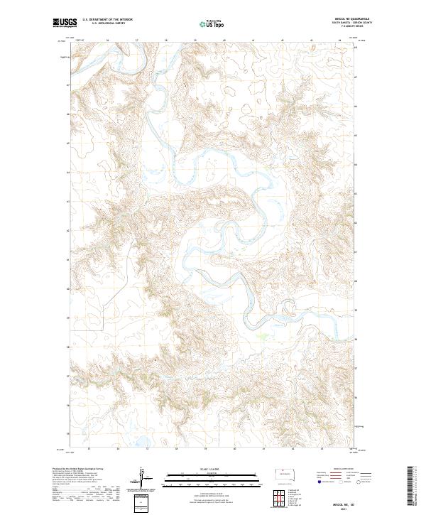
2021 Map of Miscol NE
USGS Topo · Published 2021About this map
The Grand River snakes through the northern reaches of Corson County, carving a deep, wandering path across the South Dakota landscape. This 2021 topographic map documents the river’s complex meanders and the surrounding drainage systems of the Missouri Plateau. A notable tributary, Plum Cr, flows into the river from the south, marking a significant break in the uplands. The terrain is characterized by the intricate contouring of coulees and breaks that define the river valley, illustrating the erosion patterns typical of this region. The absence of modern development highlights a landscape dominated by the Public Land Survey System, with township and range lines like t21n r25e and t20n r24e providing the primary structure for land division in this open country.
Find a feature on this map
8 named features on this map. Tap any name to fly to it.
Don’t see what you’re looking for? This feature index may not catch every label — zoom into the map to look around manually.
Map Details
Editions of this 2021 Miscol NE Map
This is the sole edition of this map. No revisions or reprints were ever made.
Other maps of this area

1953 · McIntosh
USGS Topo · 1:250,000

1956 · Miscol SW
USGS Topo · 1:24,000

1956 · Little Eagle SW
USGS Topo · 1:24,000

1956 · Bullhead
USGS Topo · 1:24,000

1956 · Miscol SE
USGS Topo · 1:24,000

1956 · Little Eagle NW
USGS Topo · 1:24,000

1956 · Miscol
USGS Topo · 1:24,000

1956 · Bullhead SW
USGS Topo · 1:24,000

1956 · Miscol NE
USGS Topo · 1:24,000

1958 · McIntosh
USGS Topo · 1:250,000