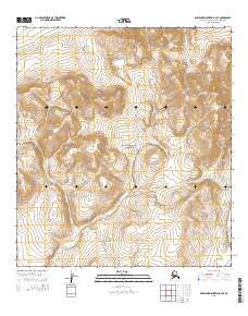
2015 Map of Misheguk Mountain A-3 SE
USGS Topo · Published 2015About this map
Noatak National Preserve encompasses the entirety of this Arctic landscape, as documented by the U.S. Geological Survey in 2015. The terrain is defined by the high-latitude drainage systems of the Noatak River basin, which appears in the southeastern corner of the quadrangle. This area serves as a critical watershed for the Sisiak Cr, which threads through the central and western sections, and Isaoktuvik Cr in the south. The map provides a precise look at the remote topography of the Brooks Range foothills, where these glacial-fed streams have carved deep channels into the mountainous slopes. While devoid of permanent human settlements or roads, the survey captures the raw hydrology of the Alaska-Northwest Arctic Borough, offering a record of this protected wilderness area in the early twenty-first century.
Find a feature on this map
10 named features on this map. Tap any name to fly to it.
Don’t see what you’re looking for? This feature index may not catch every label — zoom into the map to look around manually.
Map Details
Editions of this 2015 Misheguk Mountain A-3 SE Map
This is the sole edition of this map. No revisions or reprints were ever made.
Other maps of this area

1951 · Baird Mountains
USGS Topo · 1:250,000

1951 · Misheguk Mountain
USGS Topo · 1:250,000

1955 · Baird Mountains D-4
USGS Topo · 1:63,360

1955 · Baird Mountains D-3
USGS Topo · 1:63,360

1955 · Misheguk Mountain A-3
USGS Topo · 1:63,360

1956 · Misheguk Mountain
USGS Topo · 1:250,000

1956 · Baird Mountains
USGS Topo · 1:250,000

1965 · Baird Mountains
USGS Topo · 1:250,000
1990 · Misheguk Mountain A-2
USGS Topo · 1:63,360
2015 · Misheguk Mountain A-2 SW
USGS Topo · 1:25,000