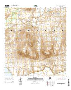
2015 Map of Misheguk Mountain A-5 SE
USGS Topo · Published 2015About this map
Noatak National Preserve encompasses much of this interior Alaskan landscape, dominated by the prominent peaks of the Uchugrak Hills. The drainage patterns of the western Arctic are clearly defined, showing the Kugururok River winding through the northern reaches before it eventually joins the larger Noatak River corridor visible at the southern edge of the sheet. In the southwest corner, the isolated Lake Narvakrak sits beneath the rising terrain, providing a stark reference point for this unpopulated wilderness area. This 2015 survey illustrates the complex hydrology of the region, where numerous unnamed tributaries feed into named systems like Sisiak Cr, reflecting the raw topography of the Northwest Arctic Borough in the early 21st century.
Find a feature on this map
12 named features on this map. Tap any name to fly to it.
Don’t see what you’re looking for? This feature index may not catch every label — zoom into the map to look around manually.
Map Details
Editions of this 2015 Misheguk Mountain A-5 SE Map
This is the sole edition of this map. No revisions or reprints were ever made.
Other maps of this area

1951 · Baird Mountains
USGS Topo · 1:250,000

1951 · Misheguk Mountain
USGS Topo · 1:250,000

1955 · Baird Mountains D-6
USGS Topo · 1:63,360

1955 · Baird Mountains D-5
USGS Topo · 1:63,360

1955 · Misheguk Mountain A-5
USGS Topo · 1:63,360
1955 · Misheguk Mountain A-4
USGS Topo · 1:63,360

1956 · Misheguk Mountain
USGS Topo · 1:250,000

1956 · Baird Mountains
USGS Topo · 1:250,000

1965 · Baird Mountains
USGS Topo · 1:250,000
2015 · Misheguk Mountain A-5 NE
USGS Topo · 1:25,000