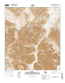
2015 Map of Misheguk Mountain C-1 SE
USGS Topo · Published 2015About this map
Noatak National Preserve encompasses a significant portion of this landscape, protecting an area where several drainages begin their journey through the Brooks Range. The topographical data highlights a complex network of high-elevation headwaters, including the southward-flowing Setting Sun Cr and the winding course of Bogie Cr. These drainages serve as the primary landmarks in a region defined by its lack of human infrastructure, where the natural terrain remains the dominant feature. The map traces the specific paths of Jubilee Cr and Stone Ring Cr as they navigate the ridges and valleys, illustrating the hydrological patterns that have carved this remote part of the North Slope over millennia.
Find a feature on this map
14 named features on this map. Tap any name to fly to it.
Don’t see what you’re looking for? This feature index may not catch every label — zoom into the map to look around manually.
Map Details
Editions of this 2015 Misheguk Mountain C-1 SE Map
This is the sole edition of this map. No revisions or reprints were ever made.
Other maps of this area

1951 · Howard Pass
USGS Topo · 1:250,000

1951 · Misheguk Mountain
USGS Topo · 1:250,000

1956 · Howard Pass
USGS Topo · 1:250,000

1956 · Misheguk Mountain
USGS Topo · 1:250,000
1984 · Misheguk Mountain C-1
USGS Topo · 1:63,360
1984 · Howard Pass C-5
USGS Topo · 1:63,360
1984 · Howard Pass B-5
USGS Topo · 1:63,360
1990 · Misheguk Mountain B-1
USGS Topo · 1:63,360
2015 · Misheguk Mountain C-1 SW
USGS Topo · 1:25,000
2015 · Misheguk Mountain B-1 NE
USGS Topo · 1:25,000