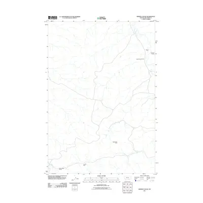
2011 Map of Mission Coulee
USGS Topo · Published 2011About this map
Rotten Grass Creek winds through this expanse of Big Horn County, defining a landscape shaped by intermittent watercourses and high plains topography. The drainage patterns are dominated by deep-set channels like Cottonwood Coulee and Eychaner Coulee, which highlight the erosive nature of the local geography. Human presence in this section of the Montana countryside is sparse, centered on the Siemion Ranch in the northeastern corner, illustrating the ranching economy that sustains this region. Further south, the terrain rises toward Rattlesnake Butte, overlooking the broad expanse of Cooper Basin. This survey provides a precise look at the land use and natural landmarks in a quiet part of the state where traditional agriculture meets the natural contours of Cooper Basin Coulee and Dry Soap Creek.
Find a feature on this map
8 named features on this map. Tap any name to fly to it.
Don’t see what you’re looking for? This feature index may not catch every label — zoom into the map to look around manually.
Map Details
Editions of this 2011 Mission Coulee Map
This is the sole edition of this map. No revisions or reprints were ever made.
Other maps of this area

1894 · St. Xavier
USGS Topo · 1:125,000

1901 · St. Xavier
USGS Topo · 1:125,000

1954 · Hardin
USGS Topo · 1:250,000

1957 · Hardin
USGS Topo · 1:250,000

1958 · Hardin
USGS Topo · 1:250,000

1960 · Schick Ranch
USGS Topo · 1:24,000

1960 · St Xavier
USGS Topo · 1:24,000

1960 · St Xavier NE
USGS Topo · 1:24,000

1960 · Mission Coulee
USGS Topo · 1:24,000
1964 · Mountain Pocket Creek
USGS Topo · 1:24,000