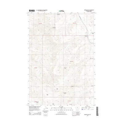
2014 Map of Mission Coulee
USGS Topo · Published 2014About this map
Rattlesnake Butte rises as a prominent landmark in this section of Big Horn County, overlooking a landscape defined by an intricate network of drainages. The area is characterized by deep coulees that carve through the terrain, such as West Dipping Vat Coulee and Eychaner Coulee. These geographical features influenced the movement and settlement patterns of the region, providing natural corridors through the high ground.
Find a feature on this map
18 named features on this map. Tap any name to fly to it.
Don’t see what you’re looking for? This feature index may not catch every label — zoom into the map to look around manually.
Map Details
Editions of this 2014 Mission Coulee Map
This is the sole edition of this map. No revisions or reprints were ever made.
Other maps of this area

1894 · St. Xavier
USGS Topo · 1:125,000

1901 · St. Xavier
USGS Topo · 1:125,000

1954 · Hardin
USGS Topo · 1:250,000

1957 · Hardin
USGS Topo · 1:250,000

1958 · Hardin
USGS Topo · 1:250,000

1960 · Schick Ranch
USGS Topo · 1:24,000

1960 · St Xavier
USGS Topo · 1:24,000

1960 · St Xavier NE
USGS Topo · 1:24,000

1960 · Mission Coulee
USGS Topo · 1:24,000
1964 · Mountain Pocket Creek
USGS Topo · 1:24,000