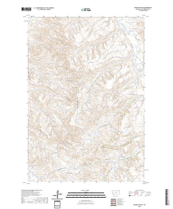
2024 Map of Mission Coulee
USGS Topo · Published 2024About this map
Rattlesnake Butte rises as a prominent landmark in this section of Big Horn County, overseeing a landscape defined by its complex drainage network and coulees. The map traces the winding course of Rotten Grass Creek through the northeastern corner, while Cottonwood Coulee cuts a deep path through the center of the quadrangle. This area is characterized by high-plateau terrain and deep basins, most notably the wide expanse of Cooper Basin near the southern boundary. Human infrastructure is sparse in this portion of the Montana landscape, represented primarily by the descriptive Good Luck Rd and the geometric precision of the Public Land Survey System. The interplay of named features like Ash Coulee and Cooper Basin Coulee reflects a traditional western geography where water and elevation dictate the shape of the land.
Find a feature on this map
14 named features on this map. Tap any name to fly to it.
Don’t see what you’re looking for? This feature index may not catch every label — zoom into the map to look around manually.
Map Details
Editions of this 2024 Mission Coulee Map
This is the sole edition of this map. No revisions or reprints were ever made.
Other maps of this area

1894 · St. Xavier
USGS Topo · 1:125,000

1901 · St. Xavier
USGS Topo · 1:125,000

1954 · Hardin
USGS Topo · 1:250,000

1957 · Hardin
USGS Topo · 1:250,000

1958 · Hardin
USGS Topo · 1:250,000

1960 · Schick Ranch
USGS Topo · 1:24,000

1960 · St Xavier
USGS Topo · 1:24,000

1960 · St Xavier NE
USGS Topo · 1:24,000

1960 · Mission Coulee
USGS Topo · 1:24,000
1964 · Mountain Pocket Creek
USGS Topo · 1:24,000