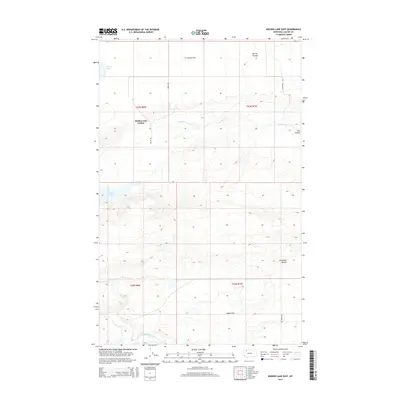
2014 Map of Mission Lake East
USGS Topo · Published 2014About this map
Seville Flat and the surrounding high plains of Glacier County define this landscape, where the agricultural community of Hidden Lake Colony is established along Welch Rd. The terrain is characterized by a series of dramatic coulees and flats, with Spring Coulee and Flat Coulee cutting through the northern reaches. Hydrology in this area is dominated by the seasonal paths of Spring Cr and the presence of Carlow Lake and Mission Lake in the northwest. To the south, the Two Medicine River meanders across the plain near Hagan Flat, while the distinct rising landforms of the Duckhead Buttes provide a clear visual landmark on the eastern edge of the survey area. This 2014 representation captures the modern road network, including Chatterton Rd and Vic Lenoir Rd, as they navigate the region's topography.
Find a feature on this map
17 named features on this map. Tap any name to fly to it.
Don’t see what you’re looking for? This feature index may not catch every label — zoom into the map to look around manually.
Map Details
Editions of this 2014 Mission Lake East Map
This is the sole edition of this map. No revisions or reprints were ever made.
Other maps of this area

1907 · Blackfoot Res.
USGS Topo · 1:48,000

1909 · Cut Bank
USGS Topo · 1:125,000

1911 · Blackfoot
USGS Topo · 1:125,000

1912 · Cut Bank
USGS Topo · 1:125,000

1914 · Heart Butte
USGS Topo · 1:125,000

1918 · Heart Butte
USGS Topo · 1:125,000

1920 · Dupuyer
USGS Topo · 1:125,000

1934 · Lake Frances
USGS Topo · 1:48,000

1937 · Lake Frances
USGS Topo · 1:62,500

1960 · Cut Bank
USGS Topo · 1:250,000