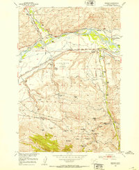
1952 Map of Mission
USGS Topo · Published 1953About this map
The Yellowstone River and the Shields River converge in this territory, defining a landscape of riparian corridors and upland ranching tracts. In the early 1950s, the Northern Pacific railroad followed the riverbanks, supporting a network of family-named holdings such as the Windsor Headquarters Ranch and the Tendland Ranch. This survey captures a moment of local infrastructure development, specifically noting the Livingston Municipal Airport while it was under construction.
Find a feature on this map
69 named features on this map. Tap any name to fly to it.
Don’t see what you’re looking for? This feature index may not catch every label — zoom into the map to look around manually.
Map Details
Editions of this 1952 Mission Map
4 editions found
Other maps of this area

1891 · Livingston
USGS Topo · 1:250,000

1893 · Livingston
USGS Topo · 1:250,000

1947 · Bozeman
USGS Topo · 1:250,000

1948 · Bozeman
USGS Topo · 1:250,000

1951 · Mount Rae
USGS Topo · 1:24,000

1951 · Chadborn
USGS Topo · 1:24,000

1951 · Grannis
USGS Topo · 1:24,000

1951 · Brisbin
USGS Topo · 1:24,000

1951 · Livingston Peak
USGS Topo · 1:24,000

1951 · Hunters Hot Springs
USGS Topo · 1:24,000