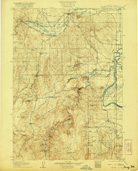
1906 Map of Mitchell Butte
USGS Topo · Published 1921About this map
Vale and Nyssa anchor the northern and eastern borders of this territory, where the early 20th-century agricultural landscape of Malheur County is defined by an extensive network of irrigation infrastructure. The Malheur River feeds a complex system of water rights, including the Farmers Ditch, Vine's Ditch, and the Gillerman and Frohman Ditch, which supported the early development of the region's farms and ranches. To the south, the landscape transitions into the high desert peaks of Grassy Mountain and Owyhee Ridge, where numerous springs like Poison Spr and Hoodoo Spr provide vital water sources in the arid terrain.
Find a feature on this map
68 named features on this map. Tap any name to fly to it.
Don’t see what you’re looking for? This feature index may not catch every label — zoom into the map to look around manually.
Map Details
Editions of this 1906 Mitchell Butte Map
3 editions found
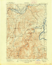
Other maps of this area

1892 · Silver City
USGS Topo · 1:125,000

1894 · Silver City
USGS Topo · 1:125,000

1897 · Weiser
USGS Topo · 1:125,000

1898 · Nampa
USGS Topo · 1:125,000

1898 · Silver City
USGS Topo · 1:125,000

1906 · Mitchell Butte
USGS Topo · 1:125,000

1950 · Jamieson
USGS Topo · 1:62,500

1951 · Malheur Butte
USGS Topo · 1:24,000

1951 · Moores Hollow
USGS Topo · 1:62,500

1951 · Payette
USGS Topo · 1:24,000