
1906 Map of Mitchell Butte
USGS Topo · Published 1906About this map
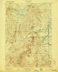
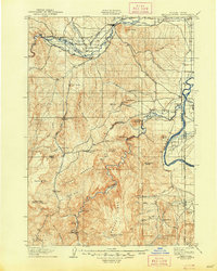
The Vale and Nyssa settlements anchor this eastern Oregon landscape at a time when irrigation was beginning to transform the arid basin. A sophisticated network of early water engineering is visible north of the Malheur River, where the Farmers Ditch, Vine's Ditch, and McLaughlin Ditch divert water to homesteads across the sagebrush. Further south, the map documents the serpentine path of the Owyhee River as it cuts through the high desert, passing beneath Mitchell Butte and through the distinctive canyon at Hole in the Ground. This survey captures the region's early ranching footprint, locating isolated outposts like Isaacs Ranch and Prices Ranch amidst a terrain defined by landmarks like Grassy Mountain and Graveyard Point. The presence of numerous named water sources, such as Hanging Rock Spring and Sagebrush Corral Spring, highlights the critical importance of reliable water for travel and livestock in the pre-dam era.
Find a feature on this map
68 named features on this map. Tap any name to fly to it.
Don’t see what you’re looking for? This feature index may not catch every label — zoom into the map to look around manually.
Map Details
Editions of this 1906 Mitchell Butte Map
3 editions found
Other maps of this area

1892 · Silver City
USGS Topo · 1:125,000

1894 · Silver City
USGS Topo · 1:125,000

1897 · Weiser
USGS Topo · 1:125,000

1898 · Nampa
USGS Topo · 1:125,000

1898 · Silver City
USGS Topo · 1:125,000

1950 · Jamieson
USGS Topo · 1:62,500

1951 · Malheur Butte
USGS Topo · 1:24,000

1951 · Moores Hollow
USGS Topo · 1:62,500

1951 · Payette
USGS Topo · 1:24,000

1955 · Baker
USGS Topo · 1:250,000