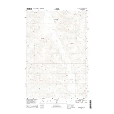
2014 Map of Mitchell Coulee
USGS Topo · Published 2014About this map
Rosebud Cr meanders through this portion of Rosebud County, Montana, carving a complex network of drainages and topographical features in the northern plains. The landscape is defined by its deep coulees, including the central Mitchell Coulee and the southern Graham Coulee, which serve as primary channels for seasonal runoff into the larger creek systems. These natural corridors, along with the notable Chicken Coop Coulee in the northwest, illustrate the erosive patterns of the High Plains where water availability shaped early cattle ranching and land use. Secondary watercourses like Cottonwood Cr, Eagle Cr, and Udee Cr create a dense hydrologic web, while MT-447 provides the principal modern access through this sparsely populated territory. The Public Land Survey System grid highlights the organized township and range divisions, showing the enduring structure of Montana's rural land management.
Find a feature on this map
18 named features on this map. Tap any name to fly to it.
Don’t see what you’re looking for? This feature index may not catch every label — zoom into the map to look around manually.
Map Details
Editions of this 2014 Mitchell Coulee Map
This is the sole edition of this map. No revisions or reprints were ever made.
Other maps of this area

1954 · Hardin
USGS Topo · 1:250,000

1954 · Forsyth
USGS Topo · 1:250,000

1957 · Hardin
USGS Topo · 1:250,000

1957 · Forsyth
USGS Topo · 1:250,000

1958 · Forsyth
USGS Topo · 1:250,000

1958 · Hardin
USGS Topo · 1:250,000

1971 · Hammond Draw NW
USGS Topo · 1:24,000

1971 · Colstrip East
USGS Topo · 1:24,000

1971 · Smith Creek NE
USGS Topo · 1:24,000
1971 · John Hen Creek
USGS Topo · 1:24,000