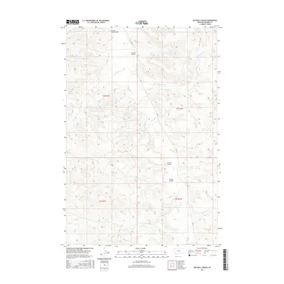
2017 Map of Mitchell Coulee
USGS Topo · Published 2017About this map
Rosebud Cr and its many seasonal tributaries define this section of Rosebud County, where the high plains are deeply incised by a network of drainage features. These coulees, such as Mitchell Coulee and Graham Coulee, reveal a landscape shaped by intermittent water flow through Montana's semiarid ranching country. The topography is marked by significant elevation changes between the creek bottoms and the surrounding uplands, which are divided into public land survey sections including t4n r42e and t4n r43e.
Find a feature on this map
17 named features on this map. Tap any name to fly to it.
Don’t see what you’re looking for? This feature index may not catch every label — zoom into the map to look around manually.
Map Details
Editions of this 2017 Mitchell Coulee Map
This is the sole edition of this map. No revisions or reprints were ever made.
Other maps of this area

1954 · Hardin
USGS Topo · 1:250,000

1954 · Forsyth
USGS Topo · 1:250,000

1957 · Hardin
USGS Topo · 1:250,000

1957 · Forsyth
USGS Topo · 1:250,000

1958 · Forsyth
USGS Topo · 1:250,000

1958 · Hardin
USGS Topo · 1:250,000

1971 · Hammond Draw NW
USGS Topo · 1:24,000

1971 · Colstrip East
USGS Topo · 1:24,000

1971 · Smith Creek NE
USGS Topo · 1:24,000
1971 · John Hen Creek
USGS Topo · 1:24,000