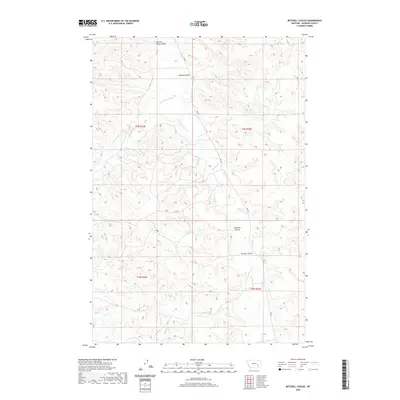
2020 Map of Mitchell Coulee
USGS Topo · Published 2020About this map
Rosebud County's intricate drainage systems are clearly defined on this 2020 survey, where the intermittent waters of Rosebud Cr and its many tributaries carve a complex path through the high plains. Named for the topographic depressions common to the region, features like Mitchell Coulee and Graham Coulee characterize the local relief. The map illustrates a landscape shaped by seasonal hydrology, with Cottonwood Cr and the smaller Sawmill Cr branching across the terrain. Human infrastructure is notably sparse, represented primarily by the winding route of Rte 447, which provides the main north-south passage through these drainages. For the historian or researcher, the map preserves the specific nomenclature of the land, from the descriptive Chicken Coop Coulee to the family-named Howard Coulee, reflecting a long history of ranching and land use in this part of Montana.
Find a feature on this map
17 named features on this map. Tap any name to fly to it.
Don’t see what you’re looking for? This feature index may not catch every label — zoom into the map to look around manually.
Map Details
Editions of this 2020 Mitchell Coulee Map
This is the sole edition of this map. No revisions or reprints were ever made.
Other maps of this area

1954 · Hardin
USGS Topo · 1:250,000

1954 · Forsyth
USGS Topo · 1:250,000

1957 · Hardin
USGS Topo · 1:250,000

1957 · Forsyth
USGS Topo · 1:250,000

1958 · Forsyth
USGS Topo · 1:250,000

1958 · Hardin
USGS Topo · 1:250,000

1971 · Hammond Draw NW
USGS Topo · 1:24,000

1971 · Colstrip East
USGS Topo · 1:24,000

1971 · Smith Creek NE
USGS Topo · 1:24,000
1971 · John Hen Creek
USGS Topo · 1:24,000