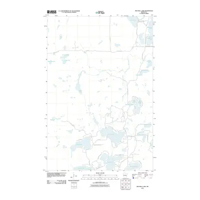
2010 Map of Mitchell Lake
USGS Topo · Published 2010About this map
Mitchell Lake serves as a central hub for this water-rich corridor of Crow Wing County, where numerous glacial basins are connected by the winding course of Daggett Brook. The landscape is defined by its irregular shorelines and dense clusters of named lakes, including Washburn Lake to the north and the connected Eagle Lake and Butterfield Lake systems to the south. The small settlement of Allens Acres sits near the western shore of Kego Lake, illustrating the residential development typical of the region's recreational lakes. Water levels throughout this network are influenced by the George Lake Dam located at the northern outlet of Lake George. Navigation through this wooded terrain is facilitated by a network of county highways and local routes like Bluebird Ave and Jermark Rd, while recreational access is highlighted by the Pine Ridge Hiking Trl.
Find a feature on this map
51 named features on this map. Tap any name to fly to it.
Don’t see what you’re looking for? This feature index may not catch every label — zoom into the map to look around manually.
Map Details
Editions of this 2010 Mitchell Lake Map
This is the sole edition of this map. No revisions or reprints were ever made.
Other maps of this area

1913 · Cuyuna
USGS Topo · 1:62,500

1915 · Cuyuna
USGS Topo · 1:62,500

1953 · Duluth
USGS Topo · 1:250,000

1953 · Brainerd
USGS Topo · 1:250,000

1957 · Brainerd
USGS Topo · 1:250,000

1958 · Brainerd
USGS Topo · 1:250,000

1958 · Duluth
USGS Topo · 1:250,000

1959 · Lower Whitefish Lake
USGS Topo · 1:24,000

1960 · Cross Lake
USGS Topo · 1:24,000

1965 · Brainerd
USGS Topo · 1:250,000