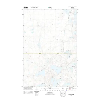
2013 Map of Mitchell Lake
USGS Topo · Published 2013About this map
Mitchell Lake serves as a central focal point for this glaciated landscape in northern Minnesota, where a dense network of water bodies defines the terrain. The border between Cass County and Crow Wing County bisects the area, with Daggett Brook winding through various basins including Washburn Lake and Snowshoe Lake. The map reveals a leisure-oriented landscape, noted by the presence of Edgewild Resort Rd near W Fox Lake and the Pine Ridge Hiking Trl winding through the woods near Eagle Lake. Significant local history is found in the clusters of shoreline development and named roads like Longwood Point Rd Ne and Plummer Point Rd Ne, which trace the points and bays of these glacial lakes. The proximity of distinctive features like Wolf Lake and Pug Hole Lake suggests a landscape largely shaped by post-glacial topography and early 21st-century recreational use.
Find a feature on this map
51 named features on this map. Tap any name to fly to it.
Don’t see what you’re looking for? This feature index may not catch every label — zoom into the map to look around manually.
Map Details
Editions of this 2013 Mitchell Lake Map
This is the sole edition of this map. No revisions or reprints were ever made.
Other maps of this area

1913 · Cuyuna
USGS Topo · 1:62,500

1915 · Cuyuna
USGS Topo · 1:62,500

1953 · Duluth
USGS Topo · 1:250,000

1953 · Brainerd
USGS Topo · 1:250,000

1957 · Brainerd
USGS Topo · 1:250,000

1958 · Brainerd
USGS Topo · 1:250,000

1958 · Duluth
USGS Topo · 1:250,000

1959 · Lower Whitefish Lake
USGS Topo · 1:24,000

1960 · Cross Lake
USGS Topo · 1:24,000

1965 · Brainerd
USGS Topo · 1:250,000