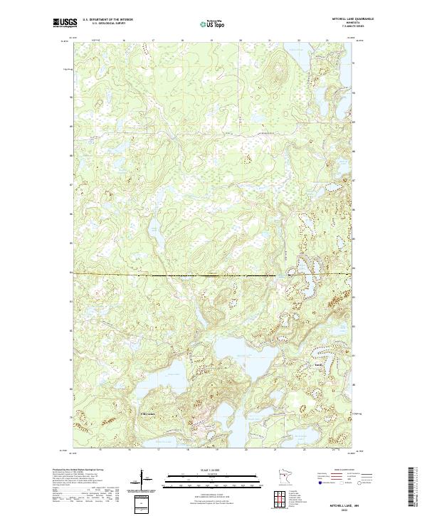
2022 Map of Mitchell Lake
USGS Topo · Published 2022About this map
Emily and Fifty Lakes anchor this landscape defined by an intricate network of glacial lakes and wetlands along the border of Cass Co and Crow Wing Co. The terrain is characterized by a dense concentration of water bodies, ranging from the large Mitchell Lake and Eagle Lake to smaller, isolated basins like Pug Hole Lake and Snowshoe Lake. This pattern of interconnected waterways and low-lying marshes suggests a region heavily shaped by glacial recession, where drainage is managed by systems like Daggett Brook and Hay Creek.
Find a feature on this map
62 named features on this map. Tap any name to fly to it.
Don’t see what you’re looking for? This feature index may not catch every label — zoom into the map to look around manually.
Map Details
Editions of this 2022 Mitchell Lake Map
This is the sole edition of this map. No revisions or reprints were ever made.
Other maps of this area

1913 · Cuyuna
USGS Topo · 1:62,500

1915 · Cuyuna
USGS Topo · 1:62,500

1953 · Duluth
USGS Topo · 1:250,000

1953 · Brainerd
USGS Topo · 1:250,000

1957 · Brainerd
USGS Topo · 1:250,000

1958 · Brainerd
USGS Topo · 1:250,000

1958 · Duluth
USGS Topo · 1:250,000

1959 · Lower Whitefish Lake
USGS Topo · 1:24,000

1960 · Cross Lake
USGS Topo · 1:24,000

1965 · Brainerd
USGS Topo · 1:250,000