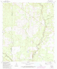
1961 Map of Mittie
USGS Topo · Published 1993About this map
Whisky Chitto Creek meanders through the piney woods of western Louisiana, defining the character of this 1960s landscape as it transitions from the mid-century into the early 1990s. The settlement of Mittie serves as a central point in an area shaped by timber and water, where an Old Railroad Grade traces a path through the northwest, marking the footprint of earlier industrial logging. Local genealogy is anchored by the Simmons Settlement and the nearby Simmons Cem, alongside rural gathering places like Cherry Grove Ch and Twin Oak Ch. The map details a hydraulic environment of smaller water bodies such as Bird Pond and Jerry Wright Lake, while the presence of the Harmony Canal and scattered Oil Wells indicates the region's managed resources and energy production during this period of development in Allen Parish.
Find a feature on this map
28 named features on this map. Tap any name to fly to it.
Don’t see what you’re looking for? This feature index may not catch every label — zoom into the map to look around manually.
Map Details
Editions of this 1961 Mittie Map
3 editions found
Other maps of this area

1935 · Mittie
USGS Topo · 1:31,680

1947 · Oberlin
USGS Topo · 1:31,680

1947 · Pine Chapel
USGS Topo · 1:31,680

1947 · Le Blanc
USGS Topo · 1:31,680

1947 · Reeves
USGS Topo · 1:31,680

1947 · Elizabeth
USGS Topo · 1:31,680

1947 · Grant
USGS Topo · 1:31,680

1947 · Bundick
USGS Topo · 1:31,680

1947 · Sugartown
USGS Topo · 1:31,680

1948 · Grant
USGS Topo · 1:24,000