
1954 Map of Moberly
USGS Topo · Published 1969About this map
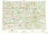
The Grand River Valley and the sprawling Missouri River Valley anchor this mid-century portrait of North Central Missouri. As updated in the late 1960s, the landscape is defined by the intersection of major rail lines like the Wabash and Chicago Burlington and Quincy with early highway corridors such as Us 36 and Us 24. Significant water management and conservation efforts are evident in the presence of the Thomas Hill Reservoir and the Swan Lake National Wildlife Refuge. Regional centers like Moberly and Chillicothe serve as hubs for the surrounding agricultural counties, while protected spaces like Pershing State Park and Van Meter State Park preserve the natural character of the river breaks and prairies. The map records the network of small towns, including Jamesport, Marceline, and Fayette, that supported the region's rural economy before further late-century consolidation.
Find a feature on this map
59 named features on this map. Tap any name to fly to it.
Don’t see what you’re looking for? This feature index may not catch every label — zoom into the map to look around manually.
Map Details
Editions of this 1954 Moberly Map
3 editions found
Other maps of this area

1885 · Warrensburg
USGS Topo · 1:125,000

1886 · Jefferson City
USGS Topo · 1:125,000

1887 · Harrisonville
USGS Topo · 1:125,000

1887 · Sedalia
USGS Topo · 1:125,000

1887 · Warrensburg
USGS Topo · 1:125,000

1888 · Boonville
USGS Topo · 1:125,000

1889 · Lexington
USGS Topo · 1:125,000

1890 · Mexico
USGS Topo · 1:125,000

1890 · Moberly
USGS Topo · 1:125,000

1890 · Glasgow
USGS Topo · 1:125,000