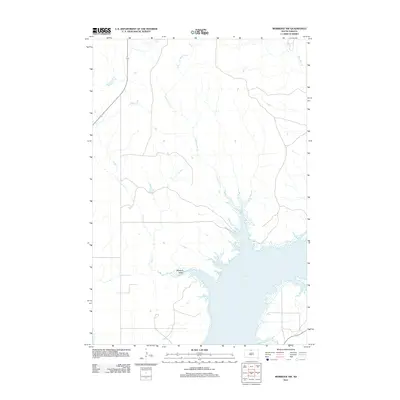
2012 Map of Mobridge NW
USGS Topo · Published 2012About this map
Lake Oahe dominates the southern landscape of this 2012 survey, where the Missouri River's dammed waters extend deep into the surrounding prairie. The terrain is defined by the drainage patterns of significant waterways like Leavenworth Cr and Fisher Cr, which carve their way toward the reservoir. In the southwestern portion of the map, the Mooquit Valley provides a distinct geographical landmark amidst the rising shoreline. This modern topographic record captures the specific water levels and road networks near the Standing Rock Reservation area, including the upper reaches of Mad Bear Cr in the northeast. The map serves as a precise document of the contemporary intersection between natural river valleys and the expansive artificial shoreline of the reservoir.
Find a feature on this map
5 named features on this map. Tap any name to fly to it.
Don’t see what you’re looking for? This feature index may not catch every label — zoom into the map to look around manually.
Map Details
Editions of this 2012 Mobridge NW Map
This is the sole edition of this map. No revisions or reprints were ever made.
Other maps of this area

1953 · McIntosh
USGS Topo · 1:250,000

1956 · Wakpala SE
USGS Topo · 1:24,000

1956 · Wakpala
USGS Topo · 1:24,000

1958 · McIntosh
USGS Topo · 1:250,000

1965 · Pollock SE
USGS Topo · 1:24,000

1966 · Kenel
USGS Topo · 1:24,000

1966 · Kline Buttes
USGS Topo · 1:24,000

1967 · Glenham
USGS Topo · 1:24,000

1967 · Mobridge NE
USGS Topo · 1:24,000

1967 · Mobridge NW
USGS Topo · 1:24,000