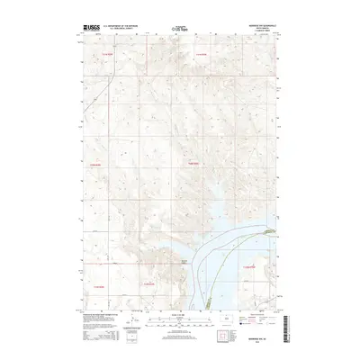
2015 Map of Mobridge NW
USGS Topo · Published 2015About this map
Lake Oahe dominates the southeastern portion of this map, representing the flooded valley of the Missouri River as it passes between Corson Co and Campbell Co. The landscape is defined by the dramatic dissection of the Missouri Plateau, where intermittent drainage systems like Leavenworth Cr and Fisher Cr have carved deep coulees into the prairie. In the south, the sheltered Mooquit Valley sits adjacent to the reservoir's edge, illustrating the complex shoreline created by the inundation of the river valley. The region is sparsely populated, with movement dictated by a grid of rural roads such as 120th St and 281st Ave. This survey captures the topographical contrast between the high tablelands and the submerged river bottom, a defining characteristic of the modern Dakotas.
Find a feature on this map
19 named features on this map. Tap any name to fly to it.
Don’t see what you’re looking for? This feature index may not catch every label — zoom into the map to look around manually.
Map Details
Editions of this 2015 Mobridge NW Map
This is the sole edition of this map. No revisions or reprints were ever made.
Other maps of this area

1953 · McIntosh
USGS Topo · 1:250,000

1956 · Wakpala SE
USGS Topo · 1:24,000

1956 · Wakpala
USGS Topo · 1:24,000

1958 · McIntosh
USGS Topo · 1:250,000

1965 · Pollock SE
USGS Topo · 1:24,000

1966 · Kenel
USGS Topo · 1:24,000

1966 · Kline Buttes
USGS Topo · 1:24,000

1967 · Glenham
USGS Topo · 1:24,000

1967 · Mobridge NE
USGS Topo · 1:24,000

1967 · Mobridge NW
USGS Topo · 1:24,000