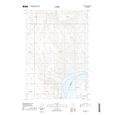
2017 Map of Mobridge NW
USGS Topo · Published 2017About this map
The Missouri River breaks of northern South Dakota are defined by the expansive waters of Lake Oahe, which dominates the southeast corner of this landscape. This 2017 survey illustrates the complex topography of the Standing Rock Indian Reservation and surrounding areas, where the terrain is deeply dissected by drainages such as Fisher Cr and Leavenworth Cr. The low-lying Mooquit Valley sits adjacent to the reservoir's edge, highlighting the dramatic elevation changes between the grassy uplands and the submerged river valley.
Find a feature on this map
15 named features on this map. Tap any name to fly to it.
Don’t see what you’re looking for? This feature index may not catch every label — zoom into the map to look around manually.
Map Details
Editions of this 2017 Mobridge NW Map
This is the sole edition of this map. No revisions or reprints were ever made.
Other maps of this area

1953 · McIntosh
USGS Topo · 1:250,000

1956 · Wakpala SE
USGS Topo · 1:24,000

1956 · Wakpala
USGS Topo · 1:24,000

1958 · McIntosh
USGS Topo · 1:250,000

1965 · Pollock SE
USGS Topo · 1:24,000

1966 · Kenel
USGS Topo · 1:24,000

1966 · Kline Buttes
USGS Topo · 1:24,000

1967 · Glenham
USGS Topo · 1:24,000

1967 · Mobridge NE
USGS Topo · 1:24,000

1967 · Mobridge NW
USGS Topo · 1:24,000