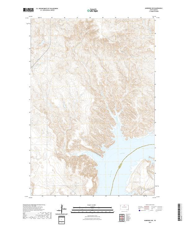
2021 Map of Mobridge NW
USGS Topo · Published 2021About this map
The Missouri River carves a deep path through the boundary of Corson Co and Campbell Co, where the impounded waters of Lake Oahe have reshaped the traditional riverbank geography. This modern survey illustrates the expansive reach of the reservoir, including the inlets of Rogo Bay and the drainage of Fisher Cr. The topography is defined by the sharp transition from the uplands down into Moosquit Valley, a low-lying area south of the primary river bend. Significant creek systems such as Leavenworth Cr and Mad Bear Cr cut through the high ground, providing a detailed look at the drainage patterns that feed into the Missouri. This map is particularly useful for understanding the current shoreline and the remaining terrestrial landmarks in a region significantly altered by mid-century hydraulic engineering.
Find a feature on this map
15 named features on this map. Tap any name to fly to it.
Don’t see what you’re looking for? This feature index may not catch every label — zoom into the map to look around manually.
Map Details
Editions of this 2021 Mobridge NW Map
This is the sole edition of this map. No revisions or reprints were ever made.
Other maps of this area

1953 · McIntosh
USGS Topo · 1:250,000

1956 · Wakpala SE
USGS Topo · 1:24,000

1956 · Wakpala
USGS Topo · 1:24,000

1958 · McIntosh
USGS Topo · 1:250,000

1965 · Pollock SE
USGS Topo · 1:24,000

1966 · Kenel
USGS Topo · 1:24,000

1966 · Kline Buttes
USGS Topo · 1:24,000

1967 · Glenham
USGS Topo · 1:24,000

1967 · Mobridge NE
USGS Topo · 1:24,000

1967 · Mobridge NW
USGS Topo · 1:24,000