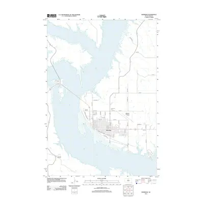
2012 Map of Mobridge
USGS Topo · Published 2012About this map
Lake Oahe dominates the western and southern landscape of this Walworth County region, shaping the development of Mobridge. The town is organized around a grid of streets such as N Main St and Railroad St E, reflecting its growth along the transportation corridors that parallel the shoreline. Cultural landmarks like the Pheasant Drive-In and the Sakakawea Monument stand as notable points of interest along the waterfront, while the Mobridge Municipal Airport sits on the eastern plateau. The transition from the dense street network of the town center to more dispersed rural routes like Peterson Trl and Flying W Rd illustrates the late 20th-century expansion of residential and industrial interests away from the water. Researchers can also locate Greenwood Cem and Grace Cem, which serve as important anchors for local family history.
Find a feature on this map
40 named features on this map. Tap any name to fly to it.
Don’t see what you’re looking for? This feature index may not catch every label — zoom into the map to look around manually.
Map Details
Editions of this 2012 Mobridge Map
This is the sole edition of this map. No revisions or reprints were ever made.
Other maps of this area

1953 · McIntosh
USGS Topo · 1:250,000

1956 · Wakpala SE
USGS Topo · 1:24,000

1956 · Wakpala
USGS Topo · 1:24,000

1958 · McIntosh
USGS Topo · 1:250,000

1967 · Glenham
USGS Topo · 1:24,000

1967 · Mobridge NE
USGS Topo · 1:24,000

1967 · Mobridge NW
USGS Topo · 1:24,000

1967 · Mobridge
USGS Topo · 1:24,000

1968 · Moreau NW
USGS Topo · 1:24,000

1968 · Moreau NE
USGS Topo · 1:24,000