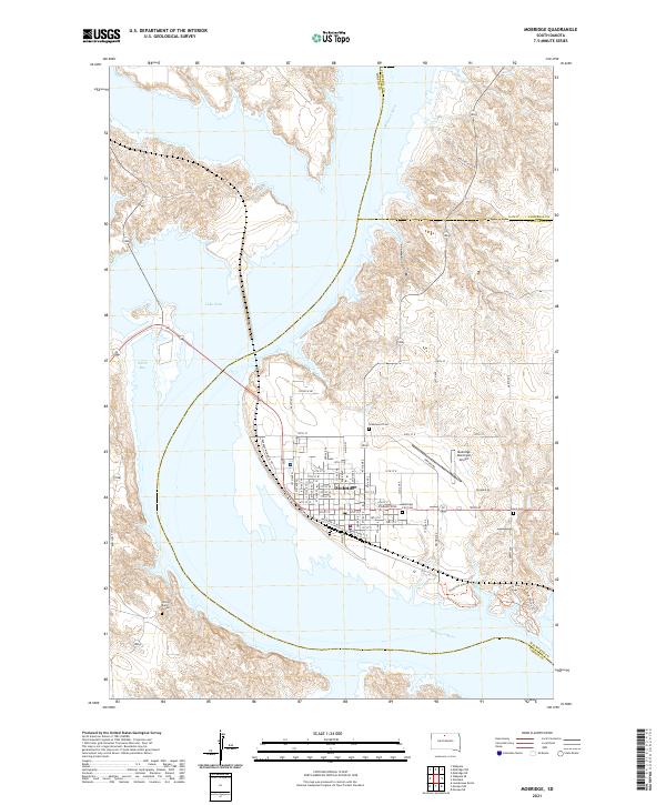
2021 Map of Mobridge
USGS Topo · Published 2021About this map
Mobridge stands at a critical bend of the Missouri River, where the town’s grid meets the expansive waters of Lake Oahe. This modern survey illustrates the intersection of historical transit and contemporary recreation, with W Railway St and Railroad St E marking the corridor that fueled the city's early development. On the western bluffs across the water lies Sitting Bull's Grave, a site of profound historical weight overlooking the inundated valley. The landscape is characterized by its proximity to the water, featuring Smith Bay to the north and a network of recreational paths including the Ringneck Hiking Trl and Turkey Run Trl to the southeast. Local history is anchored by several burial grounds, including Greenwood Cem and the Mobridge City Cem, while the Mobridge Municipal Airport marks the transition toward the prairie uplands of Walworth County.
Find a feature on this map
37 named features on this map. Tap any name to fly to it.
Don’t see what you’re looking for? This feature index may not catch every label — zoom into the map to look around manually.
Map Details
Editions of this 2021 Mobridge Map
This is the sole edition of this map. No revisions or reprints were ever made.
Other maps of this area

1953 · McIntosh
USGS Topo · 1:250,000

1956 · Wakpala SE
USGS Topo · 1:24,000

1956 · Wakpala
USGS Topo · 1:24,000

1958 · McIntosh
USGS Topo · 1:250,000

1967 · Glenham
USGS Topo · 1:24,000

1967 · Mobridge NE
USGS Topo · 1:24,000

1967 · Mobridge NW
USGS Topo · 1:24,000

1967 · Mobridge
USGS Topo · 1:24,000

1968 · Moreau NW
USGS Topo · 1:24,000

1968 · Moreau NE
USGS Topo · 1:24,000