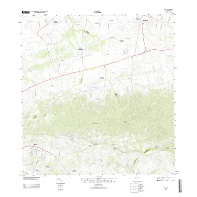
2013 Map of Moca
USGS Topo · Published 2013About this map
Moca and Isabela anchor this inland portion of the Island of Puerto Rico in 2013, where the northern coastal plains meet the rising elevations of the Cordillera Jaicoa. The map documents a transition from the urbanized corridors near the Rafael Hernandez Airport and San Antonio to the deeply incised valleys of the Rio Culebrinas watershed. Significant local landmarks like the Cementerio de Isabela and numerous family-named peaks such as Monte el Ojo and Monte Mariquilla illustrate a landscape defined by its rugged topography. The hydrologic network is dense with named streams like Quebrada de las Damas and Quebrada Dulce, which drain the limestone hills. This survey effectively captures the interface between modern transportation routes like PR-2 and the traditional rural settlements and agricultural terrain of the interior.
Find a feature on this map
36 named features on this map. Tap any name to fly to it.
Don’t see what you’re looking for? This feature index may not catch every label — zoom into the map to look around manually.
Map Details
Editions of this 2013 Moca Map
This is the sole edition of this map. No revisions or reprints were ever made.
Other maps of this area

1937 · Aguadilla
USGS Topo · 1:20,000

1937 · Moca
USGS Topo · 1:20,000

1938 · Alto Sano
USGS Topo · 1:20,000

1938 · San Sebastian
USGS Topo · 1:20,000

1938 · Quebradillas
USGS Topo · 1:20,000

1941 · Moca
USGS Topo · 1:30,000

1941 · Rincon
USGS Topo · 1:30,000

1941 · Rincon
USGS Topo · 1:30,000

1941 · Isabela
USGS Topo · 1:30,000

1941 · San Sebastian
USGS Topo · 1:30,000
Featured Places
- Moca
- Sector Nieves, Moca
- Sector Los Laureles, Aguadilla
- Ojo de Valencia, Moca
- Brisas de Monte Azul, Aguadilla