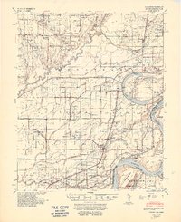
1948 Map of Modoc
USGS Topo · Published 1951About this map
Mississippi River alluvial lands define this 1948 survey, where the complex hydrology of Old Town Lake and Big Creek dictates the layout of Phillips County. The landscape is heavily marked by the river's influence, most notably at the Modoc Crevasse and the expansive Robson-Towhead. Settlement patterns follow the Missouri Pacific railroad line, connecting communities such as Lambrook, Modoc, and Lake View.
Find a feature on this map
108 named features on this map. Tap any name to fly to it.
Don’t see what you’re looking for? This feature index may not catch every label — zoom into the map to look around manually.
Map Details
Editions of this 1948 Modoc Map
3 editions found

Other maps of this area

1930 · Mellwood
USGS Topo · 1:62,500

1935 · Clarksdale
USGS Topo · 1:62,500

1939 · Farrell
USGS Topo · 1:62,500

1939 · Modoc
USGS Topo · 1:62,500

1939 · Indian Bay
USGS Topo · 1:62,500

1939 · Henrico
USGS Topo · 1:62,500

1939 · Clarksdale
USGS Topo · 1:62,500

1939 · Latour
USGS Topo · 1:62,500

1939 · Mellwood
USGS Topo · 1:62,500

1940 · Marvell
USGS Topo · 1:62,500