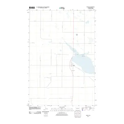
2011 Map of Moffit
USGS Topo · Published 2011About this map
Moffit centers this Burleigh County landscape, serving as a primary settlement node within a grid of rural section roads like 301st St SE and 128th Ave SE. The geography is defined by the significant reach of Long Lake, which stretches northwest from the town towards the higher ground of Moffit Butte. This area reflects a quiet agricultural and transportation pattern typical of the North Dakota plains, where small-scale aviation at the Bailery Landing Strip and the local Moffit Cemetery provide essential community landmarks. The map documents the precise intersection of regional transit routes, including Main St and 314 St SE, anchoring the town's position relative to the lake and surrounding prairie.
Find a feature on this map
18 named features on this map. Tap any name to fly to it.
Don’t see what you’re looking for? This feature index may not catch every label — zoom into the map to look around manually.
Map Details
Editions of this 2011 Moffit Map
This is the sole edition of this map. No revisions or reprints were ever made.
Other maps of this area

1951 · McKenzie
USGS Topo · 1:62,500

1951 · Driscoll
USGS Topo · 1:62,500

1954 · Bismarck
USGS Topo · 1:250,000

1958 · Bismarck
USGS Topo · 1:250,000

1971 · Moffit SW
USGS Topo · 1:24,000

1971 · Moffit SE
USGS Topo · 1:24,000

1971 · Moffit NW
USGS Topo · 1:24,000

1971 · Moffit
USGS Topo · 1:24,000

1975 · McKenzie
USGS Topo · 1:24,000

1975 · Sterling
USGS Topo · 1:24,000