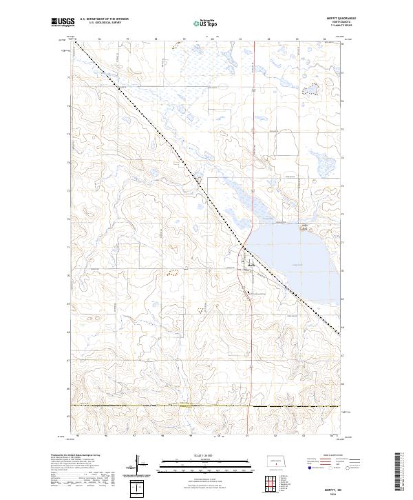
2024 Map of Moffit
USGS Topo · Published 2024About this map
Moffit sits at the heart of this prairie landscape, serving as a primary settlement point near the boundary between Burleigh Co and Emmons Co. The terrain is defined by the extensive wetlands and conservation lands of the Long Lake National Wildlife Refuge and multiple sections of the Burleigh County Waterfowl Production Area. These protected areas surround the waters of Long Lake and Long Lake Creek, illustrating a landscape dedicated to migratory bird habitat and water management. Local landmarks such as Moffit Butte rise above the surrounding plains, while the Moffit Community Cem offers a focal point for genealogical research. The map captures a grid of rural roads, including Moffit Rd and 314th St SE, which connect the town to the surrounding agricultural sections.
Find a feature on this map
30 named features on this map. Tap any name to fly to it.
Don’t see what you’re looking for? This feature index may not catch every label — zoom into the map to look around manually.
Map Details
Editions of this 2024 Moffit Map
This is the sole edition of this map. No revisions or reprints were ever made.
Other maps of this area

1951 · McKenzie
USGS Topo · 1:62,500

1951 · Driscoll
USGS Topo · 1:62,500

1954 · Bismarck
USGS Topo · 1:250,000

1958 · Bismarck
USGS Topo · 1:250,000

1971 · Moffit SW
USGS Topo · 1:24,000

1971 · Moffit SE
USGS Topo · 1:24,000

1971 · Moffit NW
USGS Topo · 1:24,000

1971 · Moffit
USGS Topo · 1:24,000

1975 · McKenzie
USGS Topo · 1:24,000

1975 · Sterling
USGS Topo · 1:24,000