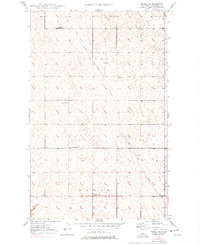
1949 Map of Mohall SW
USGS Topo · Published 1977About this map
The prairie landscape of Renville County is defined by the meandering course of Little Deep Creek, which cuts diagonally through a terrain of numerous small depressions and potholes. Surveyed in the late 1940s, this area reflects the organized township structure typical of North Dakota's agricultural heartland. The map reveals a high density of rural community centers, particularly the township schools distributed across the grid, such as Sch No 4 and School No 2. Religious life in these townships is marked by Hamerly Ch in the north and St Johns Church further south. These landmarks, along with School No 1 and School No 3, illustrate a period when local rural education and parish life were the cornerstones of the high plains social fabric.
Find a feature on this map
9 named features on this map. Tap any name to fly to it.
Don’t see what you’re looking for? This feature index may not catch every label — zoom into the map to look around manually.
Map Details
Editions of this 1949 Mohall SW Map
2 editions found
Other maps of this area

1947 · Tolley
USGS Topo · 1:62,500

1948 · Mohall
USGS Topo · 1:24,000

1948 · Tolley
USGS Topo · 1:24,000

1949 · Mohall SW
USGS Topo · 1:24,000

1949 · Mohall NE
USGS Topo · 1:24,000

1949 · Sherwood
USGS Topo · 1:24,000

1949 · Greene
USGS Topo · 1:24,000

1949 · Grano NE
USGS Topo · 1:24,000

1949 · Mouse River Park NE
USGS Topo · 1:24,000

1949 · Mouse River Park
USGS Topo · 1:24,000