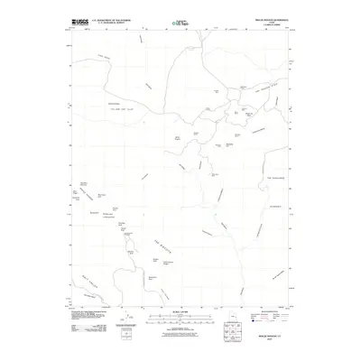
2010 Map of Mollie Hogans
USGS Topo · Published 2010About this map
Arches National Park dominates the southwestern portion of this map, showcasing a high concentration of natural sandstone spans within the Devils Garden area. This 2010 survey documents famous landmarks like Landscape Arch, Double O Arch, and Skyline Arch, along with the Fiery Furnace and Sand Dune Arch. The landscape transitions from these preserved geologic wonders toward the industrial legacy of the northeast, where the map details a cluster of mining operations. In the areas around Yellow Cat Flat and The Poison Strip, several uranium and vanadium era sites are noted, including the Ringtail Mine, Parco Mines, and the Little Eva Mine. This juxtaposition of recreational wilderness and the extractive history of Mollie Hogans and Memphis Hill provides a clear view of how land use in Grand County has evolved from resource discovery to conservation.
Find a feature on this map
51 named features on this map. Tap any name to fly to it.
Don’t see what you’re looking for? This feature index may not catch every label — zoom into the map to look around manually.
Map Details
Editions of this 2010 Mollie Hogans Map
This is the sole edition of this map. No revisions or reprints were ever made.
Other maps of this area

1885 · La Sal
USGS Topo · 1:250,000

1952 · Moab 4 NW
USGS Topo · 1:24,000

1954 · Mt. Waas 3 NW
USGS Topo · 1:24,000

1954 · Castle Valley
USGS Topo · 1:62,500

1956 · Moab
USGS Topo · 1:250,000

1958 · Thompson
USGS Topo · 1:62,500

1958 · Cisco
USGS Topo · 1:62,500

1959 · Moab
USGS Topo · 1:250,000
1959 · Moab
USGS Topo · 1:62,500
1959 · Moab 4 NE
USGS Topo · 1:24,000