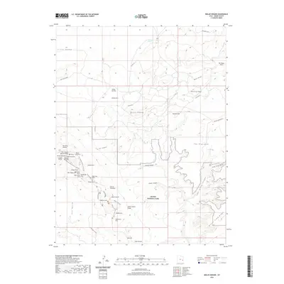
2020 Map of Mollie Hogans
USGS Topo · Published 2020About this map
Arches National Park dominates the southern half of this landscape, revealing a dense concentration of sandstone spans including the famous Landscape Arch and Double O Arch. The terrain transitions from the deep cut of Salt Valley Gorge in the west toward the high, named prominences of Mollie Hogans and Memphis Hill. This 2020 survey documents the complex network of footpaths like the Devils Garden Trail and the Devils Garden Primitive Loop Trail, which allow for the navigation of these intricate geological formations.
Find a feature on this map
51 named features on this map. Tap any name to fly to it.
Don’t see what you’re looking for? This feature index may not catch every label — zoom into the map to look around manually.
Map Details
Editions of this 2020 Mollie Hogans Map
This is the sole edition of this map. No revisions or reprints were ever made.
Other maps of this area

1885 · La Sal
USGS Topo · 1:250,000

1952 · Moab 4 NW
USGS Topo · 1:24,000

1954 · Mt. Waas 3 NW
USGS Topo · 1:24,000

1954 · Castle Valley
USGS Topo · 1:62,500

1956 · Moab
USGS Topo · 1:250,000

1958 · Thompson
USGS Topo · 1:62,500

1958 · Cisco
USGS Topo · 1:62,500

1959 · Moab
USGS Topo · 1:250,000
1959 · Moab
USGS Topo · 1:62,500
1959 · Moab 4 NE
USGS Topo · 1:24,000