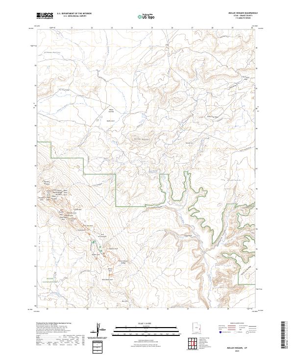
2023 Map of Mollie Hogans
USGS Topo · Published 2023About this map
Arches National Park defines the southwestern portion of this landscape, revealing a dense concentration of geological formations including the Landscape Arch, Double O Arch, and Navajo Arch. This area of Grand County is characterized by a high desert drainage system where Salt Wash and Yellow Cat Wash carve through the plateau. To the northeast, the terrain shifts toward Yellow Cat Mesa and the aptly named Poison Strip, a region historically linked to the uranium mining era of the Colorado Plateau. The map provides precise locations for numerous named natural features such as Arch de Triumphe, Gothic Arch, and Top Story Window, illustrating the intricate erosion patterns of the Entrada Sandstone. Smaller landmarks like Bati Guano Arch and Coke Oven Arch are documented alongside the winding course of Cottonwood Wash, offering a detailed view of this specialized topography before it descends into the larger valley systems.
Find a feature on this map
49 named features on this map. Tap any name to fly to it.
Don’t see what you’re looking for? This feature index may not catch every label — zoom into the map to look around manually.
Map Details
Editions of this 2023 Mollie Hogans Map
This is the sole edition of this map. No revisions or reprints were ever made.
Other maps of this area

1885 · La Sal
USGS Topo · 1:250,000

1952 · Moab 4 NW
USGS Topo · 1:24,000

1954 · Mt. Waas 3 NW
USGS Topo · 1:24,000

1954 · Castle Valley
USGS Topo · 1:62,500

1956 · Moab
USGS Topo · 1:250,000

1958 · Thompson
USGS Topo · 1:62,500

1958 · Cisco
USGS Topo · 1:62,500

1959 · Moab
USGS Topo · 1:250,000
1959 · Moab
USGS Topo · 1:62,500
1959 · Moab 4 NE
USGS Topo · 1:24,000