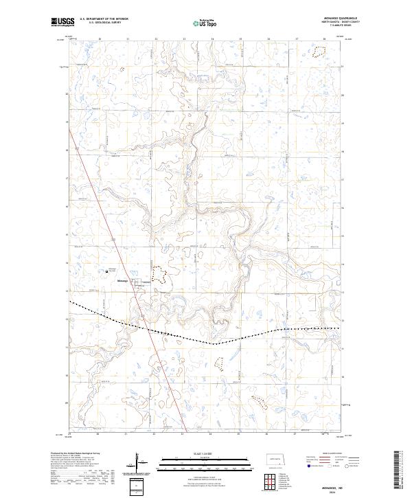
2024 Map of Monango
USGS Topo · Published 2024About this map
Monango stands as the primary settlement on this Dickey County prairie, centered at the intersection of Main Ave and local thoroughfares. The town layout is clearly defined, with the Monango City Cem located just to the northwest along the section line. The surrounding landscape is dominated by the winding path of the Maple River, which meanders through the northern and central portions of the quadrangle. In the eastern reaches, the South Fork Maple River contributes to a network of drainage and seasonal wetlands typical of the region. The map reveals a strictly organized agricultural grid of section roads, such as 85th Ave SE and Dickey Cty 3, illustrating the enduring Public Land Survey System structure that dictates the movement and settlement patterns of this North Dakota township.
Find a feature on this map
26 named features on this map. Tap any name to fly to it.
Don’t see what you’re looking for? This feature index may not catch every label — zoom into the map to look around manually.
Map Details
Editions of this 2024 Monango Map
This is the sole edition of this map. No revisions or reprints were ever made.
Other maps of this area

1894 · Monango
USGS Topo · 1:62,500

1894 · La Moure
USGS Topo · 1:62,500

1894 · Fullerton
USGS Topo · 1:62,500

1895 · Lamoure
USGS Topo · 1:125,000

1896 · Edgeley
USGS Topo · 1:125,000

1918 · La Moure
USGS Topo · 1:125,000

1925 · Edgeley
USGS Topo · 1:125,000

1953 · Jamestown
USGS Topo · 1:250,000

1956 · Jamestown
USGS Topo · 1:250,000
1956 · Ellendale North
USGS Topo · 1:24,000