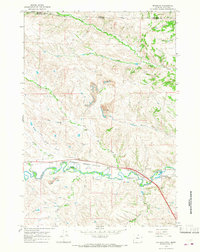
1964 Map of Monarch
USGS Topo · Published 1967About this map
Extensive industrial operations define the corridor of the Tongue River in the mid-1960s, where the coal economy of Sheridan County is clearly visible through a series of prominent Strip Mine workings. These operations follow the drainage of Slater Creek and Ash Creek, carving into the terrain north of the settlements of Monarch and Kleenburn. The landscape is a mix of heavy extraction and rural settlement, tied together by the Chicago Burlington and Quincy railroad line that skirts the river's winding path.
Find a feature on this map
23 named features on this map. Tap any name to fly to it.
Don’t see what you’re looking for? This feature index may not catch every label — zoom into the map to look around manually.
Map Details
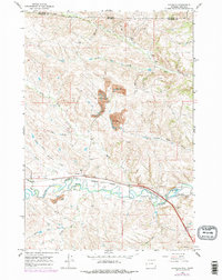
Editions of this 1964 Monarch Map
2 editions found
Other maps of this area

1894 · Rosebud
USGS Topo · 1:125,000

1895 · Dayton
USGS Topo · 1:125,000

1901 · Rosebud
USGS Topo · 1:125,000

1901 · Dayton
USGS Topo · 1:125,000

1909 · Sheridan
USGS Topo · 1:125,000

1911 · Sheridan
USGS Topo · 1:125,000

1954 · Hardin
USGS Topo · 1:250,000

1955 · Sheridan
USGS Topo · 1:250,000

1957 · Hardin
USGS Topo · 1:250,000

1958 · Hardin
USGS Topo · 1:250,000