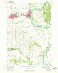
1970 Map of Monmouth
USGS Topo · Published 1972About this map
Monmouth and Independence serve as the primary hubs in this Willamette Valley landscape, where the Southern Pacific railroad corridor and the Willamette River parallel each other through fertile lowland. The campus of the Oregon College of Education anchors the western side of the map, while the riverside character is defined by the American Bottom and several prominent islands, including Wells Island and Tyson Island.
Find a feature on this map
55 named features on this map. Tap any name to fly to it.
Don’t see what you’re looking for? This feature index may not catch every label — zoom into the map to look around manually.
Map Details
Editions of this 1970 Monmouth Map
2 editions found
Other maps of this area

1912 · Jefferson
USGS Topo · 1:31,680

1913 · Wells
USGS Topo · 1:31,680

1914 · Independence
USGS Topo · 1:31,680

1914 · Soap Creek
USGS Topo · 1:31,680

1915 · Rickreall
USGS Topo · 1:31,680

1915 · Eola
USGS Topo · 1:31,680

1915 · Sidney
USGS Topo · 1:31,680

1916 · Albany
USGS Topo · 1:62,500

1917 · Salem
USGS Topo · 1:62,500

1921 · Corvallis
USGS Topo · 1:62,500