
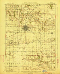
1923 Map of Monmouth
USGS Topo · Published 1923About this map
The county seat of Monmouth serves as the bustling nexus of Warren County in the early 1920s, defined by a dense grid and radiating rail lines. This agricultural landscape is remarkably dense with rural education centers, including specialized institutions like the Farmers Academy and Hickory College, alongside more than two dozen district schools such as Science Hall School and Coonville School. The presence of the County Farm south of the city reflects the era's approach to social welfare and communal agriculture.
Find a feature on this map
78 named features on this map. Tap any name to fly to it.
Don’t see what you’re looking for? This feature index may not catch every label — zoom into the map to look around manually.
Map Details
Editions of this 1923 Monmouth Map
2 editions found
Other maps of this area

1915 · Avon
USGS Topo · 1:62,500

1916 · Good Hope
USGS Topo · 1:62,500

1918 · La Harpe
USGS Topo · 1:62,500

1918 · Good Hope
USGS Topo · 1:62,500

1921 · Monmouth
USGS Topo · 1:62,500

1923 · Alexis
USGS Topo · 1:62,500

1925 · Alexis
USGS Topo · 1:62,500

1925 · Galesburg
USGS Topo · 1:62,500

1927 · Galesburg
USGS Topo · 1:62,500

1934 · Oquawka
USGS Topo · 1:48,000