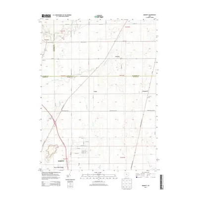
2013 Map of Monnett
USGS Topo · Published 2013About this map
Wyandot and Monnett serve as the primary hubs in this agricultural landscape where the borders of Wyandot, Crawford, and Marion counties converge. The terrain is defined by a network of drainage ways and small waterways, including the headwaters of the Sandusky River and the meandering Little Scioto River. This 2013 survey illustrates the enduring rural character of North Central Ohio, where small hamlets like Tobias and Kirkpatrick remain linked by a grid of township and state roads such as Oh-294 and the Crawford Marion Line Rd. Local family history is well-preserved through several small burial grounds, including the White Cem and Likens Cem, which are scattered throughout the sections. To the south, the transition from open farmland to suburban development is evident near Marion and the River Valley Estates residential area.
Find a feature on this map
30 named features on this map. Tap any name to fly to it.
Don’t see what you’re looking for? This feature index may not catch every label — zoom into the map to look around manually.
Map Details
Editions of this 2013 Monnett Map
This is the sole edition of this map. No revisions or reprints were ever made.
Other maps of this area

1903 · Marion
USGS Topo · 1:62,500

1905 · Marion
USGS Topo · 1:62,500

1906 · Sycamore
USGS Topo · 1:62,500

1913 · Mount Gilead
USGS Topo · 1:62,500

1915 · Bucyrus
USGS Topo · 1:62,500

1916 · Mount Gilead
USGS Topo · 1:62,500

1943 · Bucyrus
USGS Topo · 1:62,500

1943 · Mount Gilead
USGS Topo · 1:62,500

1950 · Marion
USGS Topo · 1:250,000

1960 · Oceola
USGS Topo · 1:24,000