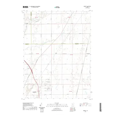
2019 Map of Monnett
USGS Topo · Published 2019About this map
The Sandusky River and Little Scioto River drain this rural landscape along the boundary of Wyandot, Crawford, and Marion Counties. Small crossroads settlements such as Wyandot, Tobias, and Kirkpatrick anchor the farming country, connected by an orderly grid of township and county roads. The terrain is notably flat, typical of the till plains of north-central Ohio, where the drainage of the land is managed through features like Muskrat Ditch. For genealogists and local historians, the map preserves the locations of several small burial grounds, including White Cem, Drake Cem, Kirkpatrick Cem, Burtsfield Cem, and Likens Cem. These rural markers are scattered across the landscape, often positioned near family landholdings and farmsteads, providing a clear view of the area's settlement patterns into the early twenty-first century.
Find a feature on this map
60 named features on this map. Tap any name to fly to it.
Don’t see what you’re looking for? This feature index may not catch every label — zoom into the map to look around manually.
Map Details
Editions of this 2019 Monnett Map
This is the sole edition of this map. No revisions or reprints were ever made.
Other maps of this area

1903 · Marion
USGS Topo · 1:62,500

1905 · Marion
USGS Topo · 1:62,500

1906 · Sycamore
USGS Topo · 1:62,500

1913 · Mount Gilead
USGS Topo · 1:62,500

1915 · Bucyrus
USGS Topo · 1:62,500

1916 · Mount Gilead
USGS Topo · 1:62,500

1943 · Bucyrus
USGS Topo · 1:62,500

1943 · Mount Gilead
USGS Topo · 1:62,500

1950 · Marion
USGS Topo · 1:250,000

1960 · Oceola
USGS Topo · 1:24,000