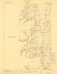
1922 Map of Monroe
USGS Topo · Published 1922About this map
The Long Tom River and the winding Muddy Creek define the lowlands of the southern Willamette Valley as it appeared in the early 1900s. Monroe stands as a central hub where the Southern Pacific railroad meets the Pacific Highway, illustrating the transition from river-based transport to rail and early motor routes. To the west, the foothills of the Coast Range rise toward Sheridan Peak, while the valley floor is dotted with small agricultural settlements and rural schoolhouses such as Oak Ridge School, Irish Bend School, and Belknap School.
Find a feature on this map
51 named features on this map. Tap any name to fly to it.
Don’t see what you’re looking for? This feature index may not catch every label — zoom into the map to look around manually.
Map Details
Editions of this 1922 Monroe Map
4 editions found

Other maps of this area

1909 · Harrisburg
USGS Topo · 1:31,680

1909 · Elmira
USGS Topo · 1:62,500

1910 · Eugene
USGS Topo · 1:62,500

1911 · Monroe
USGS Topo · 1:31,680

1911 · Inavale
USGS Topo · 1:31,680

1912 · Halsey
USGS Topo · 1:62,500

1913 · Philomath
USGS Topo · 1:31,680

1913 · Oakville
USGS Topo · 1:31,680

1916 · Albany
USGS Topo · 1:62,500

1921 · Corvallis
USGS Topo · 1:62,500