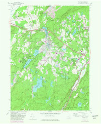
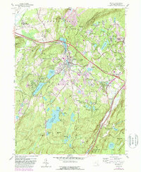
1957 Map of Monroe
USGS Topo · Published 1981About this map
Mombasha Lake and the surrounding highlands of the Hudson Valley anchor this mid-century topographic study, which captures the region's evolution into a residential and recreational hub. The village of Monroe serves as the central focal point, showing a dense network of streets and local institutions like St Patricks Sch and Seamanville Cem. To the east, the village of Harriman and the rail hub at Newburgh Junction illustrate the area's importance as a transportation corridor, with the Conrail line cutting through the valley.
Find a feature on this map
73 named features on this map. Tap any name to fly to it.
Don’t see what you’re looking for? This feature index may not catch every label — zoom into the map to look around manually.
Map Details
Editions of this 1957 Monroe Map
5 editions found
Other maps of this area

1891 · Greenwood Lake
USGS Topo · 1:62,500

1891 · Ramapo
USGS Topo · 1:62,500

1893 · Greenwood Lake
USGS Topo · 1:62,500

1893 · Ramapo
USGS Topo · 1:62,500

1902 · Schunemunk
USGS Topo · 1:62,500

1903 · Greenwood Lake
USGS Topo · 1:62,500

1906 · Goshen
USGS Topo · 1:62,500

1908 · Goshen
USGS Topo · 1:62,500

1910 · Ramapo
USGS Topo · 1:62,500

1910 · Greenwood Lake
USGS Topo · 1:62,500