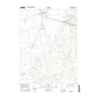
2016 Map of Monroeville
USGS Topo · Published 2016About this map
The West Branch Huron River and East Branch Huron River converge near the western edge of Norwalk, defining the agricultural landscape of Huron County. Small communities such as Monroeville, Standardsburg, and Peru are situated along these waterways and their tributaries like Frink Run and Cole Creek. This area is notable for its dense concentration of early burial sites, providing significant data for genealogists. The map documents several religiously and historically significant locations, including Saint Joseph Cem in Monroeville and Saint Pauls Cem near Norwalk. The rural character of the region is punctuated by scattered settlements like Pontiac and Havana, connected by a grid of township and county roads. Features like the Contractors Realty Corporation Pond and the Axe Factory Cem reflect the local industry and community heritage that has shaped this part of northern Ohio over generations.
Find a feature on this map
88 named features on this map. Tap any name to fly to it.
Don’t see what you’re looking for? This feature index may not catch every label — zoom into the map to look around manually.
Map Details
Editions of this 2016 Monroeville Map
This is the sole edition of this map. No revisions or reprints were ever made.
Other maps of this area

1901 · Bellevue
USGS Topo · 1:62,500

1903 · Bellevue
USGS Topo · 1:62,500

1904 · Sandusky
USGS Topo · 1:62,500

1915 · Norwalk
USGS Topo · 1:62,500

1915 · Siam
USGS Topo · 1:62,500

1944 · Norwalk
USGS Topo · 1:62,500

1956 · Toledo
USGS Topo · 1:250,000

1959 · Kimball
USGS Topo · 1:24,000

1959 · Milan
USGS Topo · 1:24,000
1959 · Bellevue
USGS Topo · 1:24,000