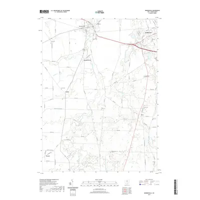
2019 Map of Monroeville
USGS Topo · Published 2019About this map
Monroeville and the western outskirts of Norwalk anchor this landscape where several branches of the Huron River converge. The West Branch Huron River and the East Branch Huron River wind through the central portion of the quadrangle, creating a series of deep ravines and wooded bottomlands that disrupt the surrounding agricultural grid. These waterways meet just north of the village, following a path toward Lake Erie. Small clusters of homes and historic crossroads define the rural character, including Standardsburg, Peru, and Havana.
Find a feature on this map
86 named features on this map. Tap any name to fly to it.
Don’t see what you’re looking for? This feature index may not catch every label — zoom into the map to look around manually.
Map Details
Editions of this 2019 Monroeville Map
This is the sole edition of this map. No revisions or reprints were ever made.
Other maps of this area

1901 · Bellevue
USGS Topo · 1:62,500

1903 · Bellevue
USGS Topo · 1:62,500

1904 · Sandusky
USGS Topo · 1:62,500

1915 · Norwalk
USGS Topo · 1:62,500

1915 · Siam
USGS Topo · 1:62,500

1944 · Norwalk
USGS Topo · 1:62,500

1956 · Toledo
USGS Topo · 1:250,000

1959 · Kimball
USGS Topo · 1:24,000

1959 · Milan
USGS Topo · 1:24,000
1959 · Bellevue
USGS Topo · 1:24,000