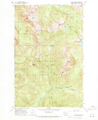
1965 Map of Monte Cristo
USGS Topo · Published 1971About this map
Monte Cristo serves as the focal point for this high-altitude survey, situated at the headwaters of the South Fork Sauk River. The area reflects a transition from its mining heyday to a more recreational or administrative phase within the Mt Baker National Forest. While Monte Cristo remains a named settlement, the map identifies nearby historic hubs like Mineral City (Site) and Galena (Site) as former sites, tracing the footprint of the Cascades' extractive history.
Find a feature on this map
46 named features on this map. Tap any name to fly to it.
Don’t see what you’re looking for? This feature index may not catch every label — zoom into the map to look around manually.
Map Details
Editions of this 1965 Monte Cristo Map
5 editions found

Other maps of this area

1899 · Glacier Peak
USGS Topo · 1:125,000

1899 · Stillaguamish
USGS Topo · 1:125,000

1901 · Glacier Peak
USGS Topo · 1:125,000

1901 · Stilaguamish
USGS Topo · 1:125,000

1902 · Skykomish
USGS Topo · 1:125,000

1905 · Skykomish
USGS Topo · 1:125,000

1921 · Sultan
USGS Topo · 1:125,000

1923 · Sultan
USGS Topo · 1:125,000

1955 · Concrete
USGS Topo · 1:250,000

1957 · Silverton
USGS Topo · 1:62,500