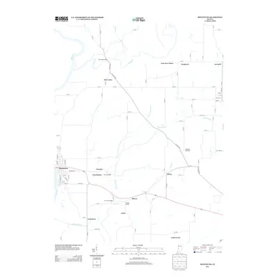
2013 Map of Montezuma
USGS Topo · Published 2013About this map
The Wabash River forms the western boundary of this landscape, where the flatlands of Hethcoe Bottoms transition into a network of small agricultural settlements and historic crossings. Montezuma serves as the primary hub, with surrounding rural communities including Annapolis, West Union, and Armiesburg defining the local geography. The area is notable for its numerous stream crossings, including the West Union Bridge over Sugar Creek and several structures over Rocky Run, such as the Sim Smith Bridge and Phillips Bridge.
Find a feature on this map
40 named features on this map. Tap any name to fly to it.
Don’t see what you’re looking for? This feature index may not catch every label — zoom into the map to look around manually.
Map Details
Editions of this 2013 Montezuma Map
This is the sole edition of this map. No revisions or reprints were ever made.
Other maps of this area

1948 · Wallace
USGS Topo · 1:24,000

1951 · Clinton
USGS Topo · 1:24,000

1951 · Mecca
USGS Topo · 1:24,000

1952 · Catlin
USGS Topo · 1:24,000

1953 · Indianapolis
USGS Topo · 1:250,000

1955 · Rockville
USGS Topo · 1:24,000

1955 · Kingman
USGS Topo · 1:24,000

1955 · Montezuma
USGS Topo · 1:24,000

1955 · Dana
USGS Topo · 1:24,000
1955 · Newport
USGS Topo · 1:24,000