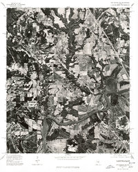
1975 Map of Montgomery NW
USGS Topo · Published 1977About this map
The Alabama River winds significantly through this portion of Autauga County, its broad meanders and oxbow formations defining the southern landscape in the mid-1970s. This orthophotograph, derived from high-altitude aerial imagery, reveals a complex pattern of land use where large-scale agriculture and forested bottomlands meet expanding residential developments. The high-contrast imagery highlights the texture of the riverbanks and the industrial and transportation corridors that bridge the water, providing a visual record of the region's topography before later urban expansion altered the rural and riparian character of the northwest Montgomery area.
Find a feature on this map
1 named feature on this map. Tap any name to fly to it.
Don’t see what you’re looking for? This feature index may not catch every label — zoom into the map to look around manually.
Map Details
Editions of this 1975 Montgomery NW Map
This is the sole edition of this map. No revisions or reprints were ever made.
Other maps of this area

1891 · Clanton
USGS Topo · 1:125,000

1901 · Wetumpka
USGS Topo · 1:125,000

1903 · Wetumpka
USGS Topo · 1:125,000

1927 · Montgomery
USGS Topo · 1:48,000

1930 · Montgomery
USGS Topo · 1:62,500

1953 · Montgomery
USGS Topo · 1:250,000

1956 · Montgomery
USGS Topo · 1:250,000

1957 · Montgomery
USGS Topo · 1:250,000

1957 · Autaugaville
USGS Topo · 1:62,500

1958 · Montgomery
USGS Topo · 1:62,500